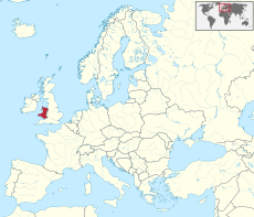
Category:Wales
Jump to navigation
Jump to search
Constituent countries of the United Kingdom: England · Northern Ireland · Scotland · Wales – British Crown dependencies: Bailiwick of Guernsey · Isle of Man · Jersey
British overseas territories: Akrotiri and Dhekelia · Anguilla · Bermuda · British Antarctic Territory · British Indian Ocean Territory · British Virgin Islands · Cayman Islands · Falkland Islands · Gibraltar · Pitcairn Islands · Saint Helena, Ascension and Tristan da Cunha · South Georgia and the South Sandwich Islands · Turks and Caicos Islands
British overseas territories: Akrotiri and Dhekelia · Anguilla · Bermuda · British Antarctic Territory · British Indian Ocean Territory · British Virgin Islands · Cayman Islands · Falkland Islands · Gibraltar · Pitcairn Islands · Saint Helena, Ascension and Tristan da Cunha · South Georgia and the South Sandwich Islands · Turks and Caicos Islands
country in north-west Europe; part of the United Kingdom | |||||
| Upload media | |||||
| Pronunciation audio | |||||
|---|---|---|---|---|---|
| Instance of | |||||
| Part of |
| ||||
| Patron saint | |||||
| Location |
| ||||
| Capital |
| ||||
| Legislative body | |||||
| Executive body | |||||
| Official language | |||||
| Anthem | |||||
| Currency |
| ||||
| Head of government |
| ||||
| Has part(s) |
| ||||
| Start time |
| ||||
| Inception |
| ||||
| Highest point | |||||
| Population |
| ||||
| Area |
| ||||
 | |||||
 Wales is one of the four nations of the United Kingdom of Great Britain and Northern Ireland. |
Subcategories
This category has the following 26 subcategories, out of 26 total.
!
- Gallery pages of Wales (13 P)
?
A
B
C
E
F
G
H
I
M
N
O
P
- Plays from Wales (16 F)
R
S
U
- Users in Wales (4 P)
V
Τ
Media in category "Wales"
The following 200 files are in this category, out of 633 total.
(previous page) (next page)-
A cruise ship entering the Mouth of the Severn - geograph.org.uk - 5425876.jpg 1,024 × 768; 557 KB
-
A little way below the mapped low water mark - geograph.org.uk - 5419534.jpg 2,122 × 1,591; 483 KB
-
A quiet morning on Bangor Pier - geograph.org.uk - 5375864.jpg 1,024 × 768; 137 KB
-
A very low tide - geograph.org.uk - 4846601.jpg 4,896 × 3,672; 6.21 MB
-
A view from below The Rath - geograph.org.uk - 5669582.jpg 5,136 × 2,889; 3.14 MB
-
A5 Sunset (28053279973).jpg 15,037 × 3,153; 29.35 MB
-
Aberystwyth jetty at sunset - geograph.org.uk - 4932892.jpg 3,954 × 2,965; 3.6 MB
-
Abraham's Bosom, Holy Island - geograph.org.uk - 5445985.jpg 3,184 × 2,123; 2.07 MB
-
Across Anglas Bay - geograph.org.uk - 5159577.jpg 4,000 × 3,000; 2.08 MB
-
Across Parwyd inlet - geograph.org.uk - 5557604.jpg 4,000 × 3,000; 2.01 MB
-
Across the bay, Abraham's Bosom - geograph.org.uk - 5469091.jpg 4,000 × 2,114; 1.29 MB
-
Afon Cynffig - geograph.org.uk - 3834512.jpg 640 × 480; 62 KB
-
Afon Menai shore - geograph.org.uk - 5334939.jpg 640 × 480; 88 KB
-
Along the beach near low water - geograph.org.uk - 5419545.jpg 2,448 × 1,836; 714 KB
-
Anarawd ap Rhodri.png 325 × 282; 138 KB
-
Anglesey from Garth Pier - geograph.org.uk - 5309895.jpg 4,184 × 2,789; 2.54 MB
-
Another fine Deganwy sunset - geograph.org.uk - 5375856.jpg 1,024 × 768; 128 KB
-
Artificial reefs off Borth - geograph.org.uk - 5244838.jpg 1,024 × 682; 852 KB
-
Bae Aberffraw - geograph.org.uk - 5457318.jpg 5,184 × 3,456; 3.38 MB
-
Bangor Flats and Port Penrhyn - geograph.org.uk - 5120102.jpg 1,600 × 1,067; 430 KB
-
Bangor Pier - geograph.org.uk - 5780068.jpg 640 × 620; 74 KB
-
Bangor Pier, Viewed from The Gazelle - geograph.org.uk - 5638856.jpg 1,600 × 1,067; 523 KB
-
Barafundle Bay - geograph.org.uk - 5295280.jpg 4,928 × 3,264; 5.95 MB
-
Bay Dillyn - geograph.org.uk - 5402336.jpg 4,400 × 3,196; 4.62 MB
-
Bay View - geograph.org.uk - 5279219.jpg 6,883 × 2,999; 4.72 MB
-
Beacon off St Anne's Head - geograph.org.uk - 5145874.jpg 1,408 × 938; 1.1 MB
-
Big Pit Logo.png 369 × 321; 29 KB
-
Bitches Turbulence - geograph.org.uk - 5402331.jpg 3,111 × 2,333; 1.72 MB
-
Black Rock Sands - geograph.org.uk - 1965330.jpg 1,046 × 1,664; 249 KB
-
Borth beach - geograph.org.uk - 5602539.jpg 3,598 × 2,399; 2.01 MB
-
Borth beach - geograph.org.uk - 5602635.jpg 4,608 × 3,456; 4.05 MB
-
Borth Beach - geograph.org.uk - 5612408.jpg 4,608 × 3,456; 4.04 MB
-
Breakwater, Holyhead - geograph.org.uk - 5138349.jpg 2,000 × 1,333; 1.18 MB
-
Brighter day on Aberdovey beach - geograph.org.uk - 5265749.jpg 2,336 × 1,752; 595 KB
-
Broadhaven South - Church Rock - geograph.org.uk - 5133082.jpg 2,576 × 1,932; 1.26 MB
-
Broadhaven South and Church Rock - geograph.org.uk - 5133084.jpg 2,576 × 1,932; 1.25 MB
-
Caldey Island - geograph.org.uk - 5503389.jpg 4,896 × 3,672; 6.23 MB
-
Car transport ship in the Bristol Channel - geograph.org.uk - 5579874.jpg 1,024 × 782; 84 KB
-
Carreg Gybi - geograph.org.uk - 5664576.jpg 1,024 × 768; 345 KB
-
Carreg Mulfran - geograph.org.uk - 5603389.jpg 4,608 × 3,456; 3.34 MB
-
Carreg Mulfran Borth - geograph.org.uk - 5603637.jpg 4,608 × 3,456; 4.44 MB
-
Cemaes Bay - geograph.org.uk - 5770806.jpg 1,280 × 851; 322 KB
-
Cemaes Head - geograph.org.uk - 5648611.jpg 764 × 511; 163 KB
-
Cerrig y Barcdy - geograph.org.uk - 2219389.jpg 2,000 × 1,500; 683 KB
-
Channel in front of Cardigan Island - geograph.org.uk - 3560597.jpg 640 × 427; 67 KB
-
Chapel Point, Caldey Island - geograph.org.uk - 5130601.jpg 2,000 × 1,333; 2.41 MB
-
Church Rock off Broadhaven Beach - geograph.org.uk - 5137095.jpg 2,000 × 1,333; 1.88 MB
-
Clement Colley Walk - geograph.org.uk - 1832786.jpg 1,200 × 1,600; 441 KB
-
Cliff side remain - geograph.org.uk - 4530406.jpg 3,648 × 2,736; 3.76 MB
-
Cliff top view across Newport Bay - geograph.org.uk - 3007635.jpg 4,000 × 3,000; 3.4 MB
-
Cliffs at Ceibwr - geograph.org.uk - 5168659.jpg 2,447 × 2,447; 1.75 MB
-
Coast from Skrinkle - winter sunshine - geograph.org.uk - 5679874.jpg 2,576 × 1,932; 1.24 MB
-
Coast of Anglesey - geograph.org.uk - 4484244.jpg 640 × 426; 64 KB
-
Coastal path - geograph.org.uk - 5550582.jpg 5,396 × 3,177; 4.3 MB
-
Coastal view at Llanbadrig - geograph.org.uk - 5770999.jpg 1,280 × 851; 482 KB
-
Coastline towards Porthstinian - geograph.org.uk - 5158637.jpg 4,000 × 3,000; 2.56 MB
-
Coed Mor - geograph.org.uk - 5146475.jpg 1,024 × 683; 200 KB
-
Coedcanlas - geograph.org.uk - 4486701.jpg 2,576 × 1,932; 1.25 MB
-
Coedcanlas - geograph.org.uk - 4486704.jpg 2,576 × 1,932; 1.24 MB
-
Coedcanlas - geograph.org.uk - 4486708.jpg 2,576 × 1,932; 1.07 MB
-
Conwy Estuary - geograph.org.uk - 3352526.jpg 800 × 530; 100 KB
-
Conwy Marina from the Quay Hotel - geograph.org.uk - 4083896.jpg 640 × 480; 42 KB
-
Conwy Quay marina - geograph.org.uk - 5085913.jpg 640 × 427; 57 KB
-
Conwy Valley (29001475152).jpg 5,472 × 3,648; 3.99 MB
-
Cormorant's Rest - geograph.org.uk - 2317245.jpg 2,272 × 1,704; 1.11 MB
-
Cormorants drying off on a sandbar - geograph.org.uk - 5265694.jpg 2,391 × 1,793; 1,023 KB
-
Corsbodeiliosign.jpg 1,600 × 1,200; 471 KB
-
Cottage on the Menai Strait - geograph.org.uk - 4484160.jpg 640 × 426; 72 KB
-
Cwm Bach - geograph.org.uk - 5404918.jpg 3,264 × 2,448; 2.73 MB
-
Cwm Cywarch.jpg 4,032 × 3,024; 3.48 MB
-
Cwm Harbour - geograph.org.uk - 5778294.jpg 2,560 × 1,708; 2.2 MB
-
Cwm Maen Gwynedd.jpg 4,032 × 3,024; 5.13 MB
-
Cwmtydu Beach - geograph.org.uk - 5377530.jpg 1,078 × 808; 625 KB
-
Cymyran Bay - geograph.org.uk - 5435332.jpg 5,184 × 3,456; 4.15 MB
-
Daft Dog paddles in the surf - geograph.org.uk - 5419553.jpg 2,285 × 1,714; 533 KB
-
Daft Dog's favourite pastime - geograph.org.uk - 5416547.jpg 1,958 × 1,469; 553 KB
-
Dale beach - geograph.org.uk - 4815502.jpg 3,810 × 2,494; 4.02 MB
-
Dawn on the Menai Straits - geograph.org.uk - 4902635.jpg 640 × 480; 97 KB
-
Deganwy from the other side of the river - geograph.org.uk - 5319662.jpg 6,000 × 4,000; 3.91 MB
-
Deganwy sunset - geograph.org.uk - 4610552.jpg 2,826 × 2,114; 134 KB
-
Deganwy sunset ^2 - geograph.org.uk - 4607968.jpg 1,024 × 768; 108 KB
-
Den Point, Caldey Island - geograph.org.uk - 5130608.jpg 2,000 × 1,333; 2.25 MB
-
Diana Princess of Wales, imaginative depiction at the age of 65.jpg 1,632 × 2,912; 2.14 MB
-
Dinas Fach - geograph.org.uk - 2396595.jpg 640 × 480; 93 KB
-
Dinas Fach - geograph.org.uk - 5167560.jpg 4,000 × 3,000; 2.67 MB
-
Doc Bach-Fish Dock at Holyhead - geograph.org.uk - 2070582.jpg 1,024 × 420; 72 KB
-
Dog heaven - geograph.org.uk - 2556890.jpg 1,664 × 1,248; 270 KB
-
Dusk falls on the Conwy estuary - geograph.org.uk - 4218745.jpg 747 × 1,024; 132 KB
-
Dutchman's cave - geograph.org.uk - 4642661.jpg 1,000 × 1,000; 665 KB
-
Eel point buoy - geograph.org.uk - 3844854.jpg 640 × 480; 90 KB
-
Entrance to the Harbour - geograph.org.uk - 3410799.jpg 3,840 × 2,046; 1.07 MB
-
Eroded gully - geograph.org.uk - 1851305.jpg 640 × 480; 90 KB
-
Eroding clay - geograph.org.uk - 3909880.jpg 640 × 480; 69 KB
-
Erratic boulders uncovered by low tide - geograph.org.uk - 2218806.jpg 2,000 × 1,500; 505 KB
-
Evening Seascape, Ellins Tower, South Stack - geograph.org.uk - 3112276.jpg 3,000 × 2,000; 1.86 MB
-
Fan Fawr, Bannau Brycheiniog.jpg 4,032 × 3,024; 3.33 MB
-
Fan Fawr, Brecon Beacons.jpg 4,032 × 3,024; 3.55 MB
-
Fence at Foel Hendre - geograph.org.uk - 4726543.jpg 1,600 × 1,064; 472 KB
-
Field Fun.jpg 1,792 × 1,008; 354 KB
-
Fisherman on the rocks - geograph.org.uk - 4343547.jpg 960 × 640; 99 KB
-
Fishguard Harbour from Cwm Quay - geograph.org.uk - 5778198.jpg 2,560 × 1,708; 3.84 MB
-
Fluffy Bunnies meet Art Nude (34791431545).jpg 6,114 × 4,108; 14.42 MB
-
Flying over the Menai Straits - geograph.org.uk - 5443748.jpg 640 × 480; 191 KB
-
Footpath to the coast path - geograph.org.uk - 3383243.jpg 4,608 × 3,456; 2.37 MB
-
Freedom on the beach at Pendine - geograph.org.uk - 5419537.jpg 2,285 × 1,714; 566 KB
-
Garth Pier, Bangor - geograph.org.uk - 5511701.jpg 5,184 × 3,160; 5.51 MB
-
Gesail-fawr - geograph.org.uk - 2985583.jpg 4,250 × 2,668; 2.47 MB
-
Gilman Point - geograph.org.uk - 4336406.jpg 640 × 480; 80 KB
-
Giltar Point near Tenby - geograph.org.uk - 5133378.jpg 2,000 × 1,333; 2.08 MB
-
Glasgwm a Llyn y Fign.jpg 4,032 × 3,024; 2.7 MB
-
Go Tango Go - geograph.org.uk - 2511655.jpg 640 × 380; 105 KB
-
Going Up ... Search and Rescue Exercise in Holyhead Bay - geograph.org.uk - 3732141.jpg 2,574 × 1,574; 892 KB
-
Good black stuff - Gileston Farm - geograph.org.uk - 1823298.jpg 1,200 × 797; 1,003 KB
-
Gorse and Heather - geograph.org.uk - 5279521.jpg 3,264 × 2,448; 2.83 MB
-
Grassholm Island - geograph.org.uk - 5773765.jpg 2,532 × 2,430; 2.95 MB
-
Great Castle Head - geograph.org.uk - 3389128.jpg 1,600 × 670; 84 KB
-
Gun emplacement and Penrhyn farm - geograph.org.uk - 2218881.jpg 2,000 × 1,500; 1.12 MB
-
Gwadn, Solva - geograph.org.uk - 5403827.jpg 3,264 × 2,448; 2.58 MB
-
Gyrocoptor over Rhossili Bay - geograph.org.uk - 3983399.jpg 1,024 × 680; 109 KB
-
Harbour end - geograph.org.uk - 5507042.jpg 2,000 × 1,333; 1.98 MB
-
Haven from Llanstadwell - geograph.org.uk - 4683723.jpg 2,576 × 1,932; 1.27 MB
-
Hazelbeach - geograph.org.uk - 5143206.jpg 2,000 × 1,308; 1.36 MB
-
Hazelbeach and oil tanks - geograph.org.uk - 5143215.jpg 2,000 × 1,333; 1.18 MB
-
Headland between the Bays - geograph.org.uk - 2330757.jpg 640 × 360; 39 KB
-
Here comes Colin's boat - geograph.org.uk - 5557195.jpg 3,371 × 1,970; 1,014 KB
-
Herring gulls, oystercatchers and Criccieth Castle - geograph.org.uk - 4321658.jpg 1,600 × 1,200; 232 KB
-
High tide on the Menai Strait - geograph.org.uk - 5335145.jpg 640 × 208; 91 KB
-
Holyhead Breakwater Lighthouse - geograph.org.uk - 5511711.jpg 5,184 × 3,456; 6.18 MB
-
Holyhead Harbour - geograph.org.uk - 5625961.jpg 640 × 480; 297 KB
-
HSC Jonathan Swift glides past the Fish Dock - geograph.org.uk - 2070574.jpg 1,024 × 547; 129 KB
-
Incoming tide, Afon Menai - geograph.org.uk - 5335030.jpg 640 × 480; 61 KB
-
Inland view on Garth Pier, Bangor - geograph.org.uk - 5335875.jpg 640 × 480; 162 KB
-
Inside St Patrick's cave - geograph.org.uk - 4177733.jpg 1,600 × 1,200; 238 KB
-
Interior of South Stack lighthouse - geograph.org.uk - 4426361.jpg 2,782 × 1,987; 910 KB
-
Into the early evening sun at Cemlyn - geograph.org.uk - 5470069.jpg 4,000 × 2,192; 1.11 MB
-
Jet skiers at sunset - geograph.org.uk - 5344696.jpg 640 × 480; 51 KB
-
Jetties at oil refinery - geograph.org.uk - 5143230.jpg 2,000 × 1,333; 1.34 MB
-
Jetty - geograph.org.uk - 4551775.jpg 1,024 × 683; 201 KB
-
Jetty - geograph.org.uk - 4553063.jpg 1,024 × 683; 145 KB
-
Jetty and pipelines - geograph.org.uk - 5143751.jpg 2,000 × 1,333; 1.25 MB
-
Jetty and pipelines - geograph.org.uk - 5143776.jpg 2,000 × 1,333; 1.35 MB
-
Jetty and pipelines - geograph.org.uk - 5154728.jpg 2,000 × 1,333; 1.31 MB
-
Jetty and pipelines - geograph.org.uk - 5154737.jpg 2,000 × 1,333; 1.23 MB
-
Jetty ^ coastline on E side of Point Lynas, Anglesey - geograph.org.uk - 5233204.jpg 5,184 × 2,920; 6.43 MB
-
Just Another Bird (22859632481).jpg 4,826 × 3,217; 7.56 MB
-
Kite surfer on Ynyslas Beach - geograph.org.uk - 5708183.jpg 480 × 640; 38 KB
-
Kite Surfers, Llanddwyn Bay - geograph.org.uk - 5400240.jpg 1,600 × 1,200; 319 KB
-
Kite-surfing from Newgale Sands - geograph.org.uk - 4919310.jpg 4,961 × 3,312; 4.47 MB
-
Landing on Bardsey - geograph.org.uk - 4791577.jpg 800 × 489; 74 KB
-
Langland Bay - geograph.org.uk - 5692500.jpg 3,264 × 2,448; 2.17 MB
-
Lay Up (15564411693).jpg 4,412 × 2,936; 2.57 MB
-
Leaning forest - geograph.org.uk - 3909906.jpg 640 × 480; 38 KB
-
Lets Go Home (22230680173).jpg 5,472 × 3,648; 12.97 MB
-
Lighthouse at South Stack, Holy Island, Anglesey - geograph.org.uk - 5642358.jpg 1,600 × 1,069; 520 KB
-
Limeslade Bay - geograph.org.uk - 3130144.jpg 640 × 481; 435 KB
-
Little Quay Bay - geograph.org.uk - 2058342.jpg 640 × 480; 107 KB
-
Little Quay Bay - geograph.org.uk - 2058376.jpg 640 × 480; 133 KB
-
Little Sound, Caldey Island - geograph.org.uk - 5133345.jpg 2,000 × 1,333; 1.82 MB
-
Llanddulas Beach from Holiday Park - geograph.org.uk - 4241549.jpg 3,264 × 1,836; 1.63 MB
-
Llanddulas jetty island - geograph.org.uk - 2584385.jpg 2,304 × 1,728; 586 KB
-
Llanstadwell - geograph.org.uk - 5143195.jpg 2,000 × 1,333; 1.24 MB
-
Lleyn from Newborough - geograph.org.uk - 3520257.jpg 3,596 × 2,697; 856 KB
-
Llyn coast - geograph.org.uk - 3454925.jpg 4,000 × 3,000; 2.7 MB
-
Lobster fishing near Caldey Island - geograph.org.uk - 1880920.jpg 640 × 480; 70 KB
-
Logo Menter Iaith Sir Ddinbych.png 734 × 370; 29 KB
-
Lone sailor in Aberdaron Bay - geograph.org.uk - 2483532.jpg 640 × 480; 69 KB
-
Looking east across the bay - geograph.org.uk - 5457373.jpg 4,000 × 2,182; 1.89 MB
-
Looking inland from well out below the low tide line - geograph.org.uk - 5419695.jpg 2,285 × 1,714; 691 KB
-
Looking into inlet east of Bwn Bach - geograph.org.uk - 3011021.jpg 4,000 × 3,000; 3.27 MB
-
Looking north from cliffs above South Stack - geograph.org.uk - 5151182.jpg 3,072 × 1,728; 1.56 MB
-
Looking out to sea Porthcawl, south Wales (44409146115).jpg 5,062 × 3,375; 5.7 MB
-
Looking to Gower - geograph.org.uk - 5416546.jpg 2,122 × 1,591; 541 KB
-
Looking west towards Dinas Fawr - geograph.org.uk - 5168110.jpg 4,000 × 3,000; 2.46 MB
-
Lost lobster pot on Traeth Abererch - geograph.org.uk - 2218786.jpg 2,000 × 1,500; 764 KB
-
Menai Strait - geograph.org.uk - 5511696.jpg 5,184 × 3,456; 6.83 MB
-
Menai Strait below Plas Newydd - geograph.org.uk - 4381665.jpg 1,500 × 1,125; 1.24 MB
-
Menai Straits - geograph.org.uk - 4484164.jpg 640 × 426; 40 KB
-
Menai Straits and Bangor Pier at sunrise - geograph.org.uk - 4900619.jpg 1,600 × 1,067; 181 KB
-
Menai Suspension Bridge - geograph.org.uk - 5146477.jpg 1,024 × 683; 187 KB

.jpg/230px-Morfa_Harlech_National_Nature_Reserve_(22816405077).jpg)


.jpg/120px-Conwy_Valley_(29001475152).jpg)


.jpg/120px-Even_in_the_darkest%2C_greyest_days_of_winter%2C_she_could_always_feel_the_power_of_the_sun%2C_just_the_other_side_of_the_clouds_(31993289943).jpg)


.jpg/120px-Fluffy_Bunnies_meet_Art_Nude_(34791431545).jpg)


.jpg/120px-Just_Another_Bird_(22859632481).jpg)


.jpg/120px-Lay_Up_(15564411693).jpg)

.jpg/120px-Lets_Go_Home_(22230680173).jpg)


.jpg/120px-Looking_out_to_sea_Porthcawl%2C_south_Wales_(44409146115).jpg)


_Bridge_-_geograph.org.uk_-_4872734.jpg/120px-Menai_Bridge_from_Menai_(Suspension)_Bridge_-_geograph.org.uk_-_4872734.jpg)


